


Acme
-
Posts
2399 -
Joined
-
Last visited
Content Type
Profiles
Forums
Events
Posts posted by Acme
-
-
Understood. Nevertheless, any work entails mundane activities....
@Acme: I'm sure he's just a bit depressed. Considering state of the Oceans, can't be fun to write reports about it rather than taking more immediate action(if not as far reaching).
Your feeling is not an adequate judgment of the usefulness of the articles. Even if only 1 person read a report/article, but used it in support of other research then the writing was worthwhile.Just what I find when I look at some articles I read recently. When I find them on google scholar some of them will tell me how many readers they had so far and most of them are in the low one-hundreds. It just gives me a feeling that there is no big interest in those articles.
I'd say the majority of people aren't interested in more than popular science type reading, and if they are then prompted by popular articles they will seek out more detailed information.Anywhere. How does research reach the people who are no scientists and who would have a hard time reading a scientific report? The majority of people is receiving our work cropped down in a news article like on iflscience.com.
It might be important to know certain things sooner, yes. It's also important to do a proper job of collating and analyzing facts before releasing them. You might consider writing your own blog to disseminate information you find important, as long as you do so responsibly.We need to be changed, right? So that we can help ourselves and survive on this planet. What's the purpose of collecting data every day if it is only published after years of research sometimes when the project is done? Couldn't it be important to know certain facts beforehand?
'Main stream media' is such an overused term and little more than a strawman folks can feel satisfied in beating about the head and shoulders with a hefty cudgel. You're using a computer so you should know you can find darn near any important finding you want. Many things hidden behind paywalls online can still be found in a good old fashioned university library.Important findings should be thought to everyone because we all live here. That's what main stream media is for but sadly it is used for advertising rubbish and stuff that rather damages the environment.
Maybe I am too young to value an office as a work place.
I am not talking about not publishing any reports at all. I just don't see the point to write reports for every day in the field, every meeting, every time my colleague farts and then an annual report as well. I think it is a waste of time/money/resources.
Maybe one annual report would be enough. In the mean time, all the data gets fed into a global system and is free to access. Sure people have copy rights on it but everyone can at least see it and know what is going on before the paper work is done. Just a vision of mine...
Vision is great, but it is never achieved without putting one's nose to an elbow-greased grindstone.
I'll need that statement written up in triplicate on my desk by 7am.No comment.
 0
0 -
What evidence do you have that reports are 'barely read by anyone'?Hi community,
Since this is my first post here I will take a couple of sentences to introduce myself.
I am a 3. semester marine biology student. Over my holidays I somehow managed to work as a consultant for an international organisation in a small country in South-east Asia. I worked on a marine turtle surveying project and helped to build capacity and awareness towards conservation in this country.
Now coming back to New Zealand and going back to uni I am still working on the reports for the organisation I conducted fieldwork for.
Due to listening to Alan Watts this morning (he is a philosopher I really like), I realised like so many times before that he is right when we talk about things we like doing and things we have to do because our boss or society wants us to do so. However, especially when working in science barely people spend more than 1/3 of their time doing what they do but recording what they do. Why do we write reports which are barely read by anyone?
This is rather a vague question, Headlines where? Change what how? Outstanding why and to whom?Does scientific research ever make headlines or changes anything because of an outstanding report?
Sounds like this is the crux of the issue.Sure, I don't like writing reports and English is not my first language which is challenging sometimes wanting to be all correct as Germany told me so.
It's important because the results of research have their value in being shared. Listing facts may have merit, but often the facts/data require collation and analysis to manifest their value.I just cannot understand why writing reports to the extent we do today is so important. Wouldn't it be enough to just list facts on an international database for good?
A platform where we can upload the data we collect in the field and whoever needs it can take it. I wouldn't be surprised if something like that does exist already but is just not accepted yet because certain people want to "own" the date they collected. To me that only means that they don't give a fuck about this place and are just after money or want to boost their career.
If I would not have to write the report of my turtle research but could just feed the raw data into some kind of system I would have the time this weekend to go down to Farwell Spit where over 650 Pilot whales beached 2 days ago, get my hands dirty and do what I do or what I want to do. I could prepare for the next field trip, study or just watch a movie. Making changes for others but as a student mostly for myself. Remember that we will be life-long students. Sitting behind a computer screen to look at my data, shift it around and construct some smart words around it to sound "evident" to then have someone else look at my data does not change anything.
I am young and barely have experience. And it might not sound that way but I am living my dream. I am just not happy with the speed this planet and its' people are changing. If we would not spend so much time reporting, talking and negotiating, we might be able to make the necessary changes before it is too late.
If there is anyone here who can refer me to someone with the same idea or thoughts, please don't hesitate to give me contacts or leave your thoughts here, I'd appreciate it and probably anyone else who had a think about that subject.
Cheers,
In other words, you don't have the wherewithal to do all that is required of a researcher. Maybe you've chosen the wrong line of work.
0 -
Strange loopThis is a question, not actually a blog. Here it goes:
If the brain creates consciousness, then it has to be a conscious object. If it is a conscious object then why should we have to improve the brain's mechanism by challenging it or else it would lose its intelligence; then the brain should be able to conserve its intelligence without letting the control of its conscious parts. We know that is not the case. The case is we have to improve the brain. We are conscious of ourselves. If that is the case, then who are we? What is our potential?
I am looking forward for replies!!
...
Hofstadter argues that the psychological self arises out of a similar kind of paradox. We are not born with an "I" the ego emerges only gradually as experience shapes our dense web of active symbols into a tapestry rich and complex enough to begin twisting back upon itself. According to this view the psychological "I" is a narrative fiction, something created only from intake of symbolic data and its own ability to create stories about itself from that data. The consequence is that a perspective (a mind) is a culmination of a unique pattern of symbolic activity in our nervous systems, which suggests that the pattern of symbolic activity that makes identity, that constitutes subjectivity, can be replicated within the brains of others, and perhaps even in artificial brains.
...
Downward causality
Hofstadter thinks our minds appear to us to determine the world by way of "downward causality", which refers to a situation where a cause-and-effect relationship in a system gets flipped upside-down. Hofstadter says this happens in the proof of Gödel's incompleteness theorem:
Merely from knowing the formula's meaning, one can infer its truth or falsity without any effort to derive it in the old-fashioned way, which requires one to trudge methodically "upwards" from the axioms. This is not just peculiar; it is astonishing. Normally, one cannot merely look at what a mathematical conjecture says and simply appeal to the content of that statement on its own to deduce whether the statement is true or false. (pp. 169-170)
Hofstadter claims a similar "flipping around of causality" appears to happen in minds possessing self-consciousness. The mind perceives itself as the cause of certain feelings ("I" am the source of my desires), while according to popular scientific models, feelings and desires are strictly caused by the interactions of neurons.
1 -
Q: What is the difference between humor and odor?
A: Humor is a shift of wit.
1 -
The Massacre That Wasnt, and a Turning Point for Fake News@NYT
...
Yet by the end of the weekend, it was Ms. Conways credibility that was receiving the most scrutiny (which she described as unfair and coming from a lot of the haters in her interview with Mr. Kurtz).
Some, like the New York University journalism professor Jay Rosen, were calling upon the television networks to stop booking her. And CNN declined to have her as a guest on Sunday in part because the Trump administration offered her in lieu of Vice President Mike Pence, but also because of what the network told me were serious questions about her credibility.
...
Real Fake News >> White House Announces Super Bowl Pre-Game Show Will Feature Tribute To Bowling Green Massacre Victims
 1
1 -
Common sense, while often credited with being logical, lacks rigor. One person's common sense is another's stupidity. There's a sucker born every minute. ~Unattested
0 -
+1 StringJ! Part for the video, but most for what it led me to. After it finished, among the recommended videos was one by Sungha Jung playing a harp-ukulele. Now I'm listening to song after song by Sungha. Will be dipping in this well for days at least. 고맙습니다
0 -
4,2,1
in Mathematics
fiveworlds, if you think it is so easy, why don't you claim the prize for proving it:
http://thescienceexplorer.com/universe/earn-two-thousand-dollars-solving-simple-math-problem
From your article:
The Collatz Conjecture, also known as the 3n+1 problem, has been driving mathematicians mad since the mid 1930s when it was it was first proposed by Lothar Collatz. Although it is simple to understand as it involves nothing more than addition and division it is not simple to prove.
Heres the problem:
Take a given integer n. If it is even, divide it by 2. If it is odd, multiply it by 3 and add 1. Continue the pattern taking the answer as your new n.
Lets look at some examples:
3, 10, 5, 16, 8, 4, 2, 1
7, 22, 11, 34, 17, 52, 26, 13, 40, 20, 10, 5, 16, 8, 4, 2, 1
12, 6, 3, 10, 5, 16, 8, 4, 2, 1
21, 64, 32, 16, 8, 4, 2, 1
You will notice that for each of these numbers, you end up at 1, which would lead to an infinite loop of 1, 4, 2, 1, 4, 2, 1
But is that the case for all integers? Thats the Collatz conjecture, and it has never been proven. It has been tested for absurdly large numbers for example, the largest number of steps it takes for a number below a billion to reach 1 is 986 but nobody has been able to say for sure that no number exists that wont ever reach 1.
H. S. M. Coxeter wrote of the difficulty of finding a counter-proof to the conjecture: I must warn you not to try this in your heads or on the back of an old envelope, because the result has been tested with an electronic computer for all x1 ≤ 500,000. This means that, if the conjecture is false, the prizewinner muse [sic] either find a sequence of this kind which he can prove to be divergent, or else find a cyclic sequence for this kind whose terms are all greater than half a million.
But, if you are still insistent, there is some prize money involved. Paul Erdos said of the conjecture: "Mathematics is not yet ready for such problems," but he offered $500 for a solution. Thwaites, after whom the problem is sometimes called the Thwaites conjecture, offered up £1000 (about $1500) as well.
Shall we calculate the odds that fivwolds collects a prize? Tries to claim the prize? Just asserts here he deserves the prize? Win, place, show?
 0
0 -
The e-mail string following my report has grown a fair amount. My manager has the same ideas as Arc, i.e. that the boulder is an ice-rafted erratic. The regional geologist said he is unaware of any ice-rafted erratics in Washington, but that they likely exist. He also said my photo of the sample chip does look like basaltic andesite as I suggested. It will take a more detailed analysis of the rock to determine if its exotic to the region and depending on the origin, the ice-rafting might be affirmed or rejected.
The geologist also gave my manager a few other geology folks to contact who have worked and mapped in the area, so the string will continue stringing out. I'm feeling more hopeful that one or more experts will come out and have a look in the field. As an amateur and volunteer, it's very gratifying to have spawned so much interest among professionals.
 1
1 -
I would still not rule out river flood transport.
Near where I live, there is an ancient clapper bridge across the river Barle on Exmoor.
Winter floods have shifted/transported large stones weighing several tonnes, downstream from the structure again.
The river Barle is an inconsequential trickle compared to your american rivers in question.
Nice! We've got nothing on you when it comes to 500 year old stone bridges, even over trickles.
I'm ruling nothing out at this stage. Well, nothing reasonable. I'm not entertaining alien intervention or propositions of that ilk.
 0
0 -
Me too.Acme, I look forward to their opinion.
Definitely.Yes please tell us the results when available. +1
I have not reported on the field stone quantity in the immediate area of the boulder so there is no basis to judge that quantity. The ground is heavily covered by grasses, sedges, rushes, and forbs, with occasional patches of Rosa sp. as seen surrounding the boulder.The lack of any sign of appreciable field stone quantity at the subject site would suggest frost heave is not the agent at work here. This rather temperate region does not attain the lower temperature that those seasonally colder field stone regions do. New England winters we do not have. Interestingly though, the loss of top soil is almost universally observed in modern farming practices, this lends to the probability that many of these smaller drop stones around this area that were excavated by farming equipment in the last century are possibly not only due to frost heave but the fact that the surface is being lowered from soil loss while farming equipment has gradually increased in size and strength, thus they have over the last century gradually increased there till depth. These factors alone have assured for the continuous removal of these stones whether or not the stones themselves were rising from frost heave.
The recent [last ~200 years] history of the farming at the site has consisted of grazing stock and mowing hay. While ditches were cut in the 20's & 30's in attempts to drain the area, there has been no tillage noted in any of the reports and records that I have read. The only boulders that would have to be moved would be those sitting proud enough to interfere with haying.
Prior to the arrival of Europeans, Native Americans regularly burned the prairies to kill off shrubs & young trees and maintain the open prairies. These prairies were a major source of food where Natives dug Camas bulbs, Chocolate Lily bulbs, and Yampah roots. I have read an archaeological report for the area that mentions fire-cracked rock evidencing this burning, but exact locations were redacted by the request of the county officials. Whether these were embedded rocks or remains of Native American roasting pits for the Camas was not made clear in the report either. The burning stopped in the late 1700s after European explorers introduced smallpox; by the time Lewis & Clark visited, nearly 80% of the native population was dead.
Maybe those two are ice floated erratics and maybe not. Your conjecture is duly noted.Although, as you mentioned, graph B indicates most iceberg erratics reside to the south across the Columbia, the two examples I did furnish shows that the one to the east is completely above ground while the other being to the northwest is just breaking the ground's surface. These appear to reside where they initially landed, carried within their parental iceberg to where it had grounded and melted away. The example to the northwest was no doubt buried by the tremendous amount of silt of the Missoula Floods and the Columbia's changing river coarse as it silted up and overran its older channels. These erratics are most easily and most likely explained as erratics that lie where they dropped out of the melting iceberg and either stayed above grade or were covered over based on the local geologic conditions.
As I mentioned, I don't know whether there are, or were, any other such large boulders in/on prairies in the county. The area is heavily developed and ecologists estimate there is only about 1% of these wet prairies remaining in the whole state. This is why the area is protected.Occam's Razor would place your example with all the others, all from the same circumstances that were then mediated by various local geologic conditions. But none very far beyond the ordinary circumstances of the others. In other words: If your example was shaken to the surface than many others should have also done the same.
0 -
I sent a short report on my findings to my immediate managers; it was well received and forwarded to state geologists for review. Thanks to all who have contributed here and I'll update you on any new findings.
1 -
Nice research Arc. A flood delivered iceberg-with-erratic I might buy. Add the quake induced granular convection uplift, and voila, my boulder on top of the plain! A key bit of evidence still missing is a proper rock identification which might fix the boulder's origin. It may well be fairly local from just up the gorge. I'll be working on that, but it won't be quick. Stay tuned.An interesting feature of these flood events (maybe around 40 of them) was the icebergs. From your link;
https://en.wikipedia.org/wiki/Missoula_Floods
"As the water emerged from the Columbia River gorge, it backed up again at the 1 mile (1.6 km) wide narrows near Kalama, Washington. Some temporary lakes rose to an elevation of more than 400 ft (120 m), flooding the Willamette Valley to Eugene, Oregon and beyond. Iceberg rafted glacial erratics and erosion features are evidence of these events."
This map at the site below allows you to zoom in to amazingly close resolution.
http://www.oregongeology.org/pubs/ims/IMS-036_print.pdf
This is a screen shot of that map I made as an example of the range that the flood water could carry these icebergs that in turn were carrying the erratics. That is the Columbia River with the entire Vancouver metropolitan area within the flood zone that extends to Kalama 47 km to the north.
This site below chronicles the location of erratics around this region within the range of the flood carried Icebergs.
 Erratic Ridgefield National Wildlife Refuge Ridgefield Washington Image 3.png
 It is located at the Ridgefield National Wildlife Refuge just north of Vancouver. It looks very similar to Acme's example.
Here's another erratic located farther to the east;
http://www.waymarking.com/waymarks/WM36CY_Round_Lake_Erratic_Camas_Washington
And here's a nice video about the Lower Columbia Floods Chapter; http://iafi.org/local-chapters/lower-columbia-chapter/
They chronicle and educate about the floods around this region.
I have hiked and done botanical photographic work at both Ridgefield and Round Lake. The partially buried erratic at Ridgefield is most like what is at the boulder area as it is a predominately flat terrain with sedimentary soils. That the Round Lake erratic is sitting free and clear is not surprising as the terrain there is hilly and rocky.
I don't seem to have any photos of Round Lake itself or the terrain, but here is a shot from Oct. 2015 of the sign-board mentioned at your link. Alas it appears I did not get the part mentioned, i.e. " According to the signboard at Round Lake, the massive boulder's rounded surface and huge shape suggests it was rolled along by the enormous, extremely fast moving flows of the Missoula Floods."

This image at the Ridgefield Preserve was taken on the Autumnal Equinox of 2015. There is one relatively short hiking trail which is only open Spring to Fall, and otherwise you have to drive through. I did hike that day, but along the drive route are a few lookout stops and this photo is from one of those wildlife viewing areas.

Post Script: Looking at the flood deposits map, figure Map B shows the locations of glacier erratics and all appear to be on the Oregon side of the river, with none marked in Clark County Washington.
0 -
See? You're still treating the emergence of complexity as a totally random event, instead of seeing how complexity emerges fairly easily out of any system composed of simple, diverse, robust, chaotic parts. Do you see the big difference?
~
... Even the improbable becomes a certainty given enough chances.
I disagree with both these assertions, not the least because they employ contradictive terms. 'Complexity' is not 'easy', and 'improbable' is not 'certain'.
Sensei has come the closest to home when he invoked Miller & Urey in post # 29, and to that I would add self-organization and emergence as scientific principles that bear on the OP question, "how is evolution a reason to doubt creationism?".
0 -
How many times will a printshop explode in order to get a complete dictionary or how many times do you need to ash a scrap metal pile to "Evolve please" before you end up with a 747 ?
That's an air between the ears red herring argument. Life happened here, there are valid scientific theories about how that may have happened, and just because we're in the religion forum it does not excuse you from presenting valid scientific evidence for a divine creator. Since scientific evidence for divinity is a contradiction of terms, you have no legs to stand on.
0 -
One stalagmite mnemonic is 'it might reach the ceiling'.I just imagined that one of them needs to "stick tight" to the ceiling. I never worried about a mnemonic for stalagmites. If you knew which of one of them was the "tite", you knew the other was the "mite".
The stalagmite parts assembled during the construction look more orange or brown than the others. This is attributed to transformation by fire up to now. But could it be that clay or a similar material, that made the hypothetic reservoir watertight, incorporated to the old or new calcite over time? Analysis would tell that.
The color changes when deposition stops and/or when the material dries. Even broken pieces can continue to grow if they are being dripped on.
0 -
Nice to see folks cooperatively working through the possibilities with open minds. +1Acme and Mman
Thanks Studiot!
Let's see if I can continue that work in regards to Arc and his thoughts on the boulder being a glacier deposit.
In post #18 Arc offered a link to a study. Find it here: > Quaternary alpine glaciation in Alaska, the Pacific Northwest, Sierra Nevada, and Hawaii
In post #19 I commented on it saying:
..Your source gives a map (Fig.2 Continued) wherein the closest 3 alpine glaciers are labeled Lewis, Adams, and Toutle (Toutle corresponding to Mt. St. Helens). By the map scale, Lewis is ~ 50km, Toutle ~60km, and Adams ~100km distant from the boulder's location. Unfortunately I can find no discussion of these 3 alpine glaciers in the text of the paper. Perhaps I overlooked it? ...
The map I referenced is on pg. 6 of the document. While I still don't see any discussion of the 3 marked sites in the body of the paper, the location marked 'Lewis' looked strangely familiar. So here's the scoop, which I think is in line with my contention that no alpine glaciers came near to the area of the boulder which is +- 5 miles from the Columbia R.
Anyway, some 30 years ago I was studying geology at a local college and the instructor took us on a field trip to see some glacial deposits. The deposits were not moraines, rather they were glacial lake deposits called varves. They lie between 25 and 30 miles from the Lower Columbia as it sweeps past Vancouver and turns N. I suspect that were there closer glacial deposits, the instructor would have taken us there. My mind being sieve-like notwithstanding, I'm inclined to think I would remember mention of glacial deposits near the Columbia R. I'm certainly open to any evidence contrary to my recollections.
Fast forward to a few years ago when I took some young people up to see the varves and help me take some measurements, locate them with GPS, and take samples. If you all will indulge me, here are the results.

So I took the coordinates of 3 exposures and they appear to correspond with the Lewis site marked on the map in the study. They are:
#1 45°56'41.39"N 122°16'28.24"W
#2 45°56'44.00"N 122°16'0.06"W
#3 45°55'34.65"N 122°13'32.07"W
Here's a shot of us measuring the height of an exposure and the measure was 30 ft.

This is a wider view of the measured exposure. (The bright area is water seeping out.)

Here is a shot showing erratics in the varve. These occur when a larger rock falls out onto the frozen surface of the lake, and then falls to the bottom during the seasonal thaw.

Finally, this is a shot of a sample with a scale. I didn't count the layers again, but my notes say 15 layers. So 15 layers in 2.5" and with a measured exposure of 30 ft. we get a rough estimate of 1,800 years for the lakes age. Not only is this rough because the layers differ widely in thickness, but I don't know how much of the top of the deposit was eroded or how much lay below the level of the roadbed it adjoins. (Neither do I know the period of the deposits.)

Well, a bit of a digression perhaps, but fun all the same.
0 -
I had some plant cataloging to do in the field today so I took time to photograph some of the typical boulders in the area. The stick is 42" long for scale. The pile is the result of past farming efforts, which were never successful at this location beyond grazing stock. The stock grazing began with the establishment of Fort Vancouver in the early 1800s and ended about 20 years ago.

 1
1 -
Frost heave could indeed be the culprit but a large earth quake could have lifted a rock through sediments to sit on the top. Take a can of pebbles of various sizes and sand, shake it up and watch the larger bits rise to the top of the can... It would be odd this is the only stone lifted in this manner...
That is the granular convection I have been talking about, otherwise known as 'the Brazil nut effect'. I gave a link in post #3 and Wiki has an article as well. > Granular convection
Geology
In geology, the effect is common in formerly glaciated areas such as New England and areas in regions of permafrost where the landscape is shaped into hummocks by frost heave new stones appear in the fields every year from deeper underground. Horace Greeley noted "Picking stones, is a never-ending labor on one of those New England farms. Pick as closely as you may, the next plowing turns up a fresh eruption of boulders and pebbles, from the size of a hickory nut to that of a tea-kettle." [9] A hint to the cause appears in his further description that "this work is mainly to be done in March or April, when the earth is saturated with ice-cold water". Underground water freezes, lifting all particles above it. As the water starts to melt, smaller particles can settle into the opening spaces while larger particles are still raised. By the time ice no longer supports the larger rocks, they are at least partially supported by the smaller particles that slipped below them. Repeated freeze-thaw cycles in a single year speeds up the process.
This phenomenon is one of the causes of inverse grading which can be observed in many situations including soil liquefaction during earthquakes or mudslides. Granular convection is also exemplified by debris flow, which is a fast moving, liquefied landslide of unconsolidated, saturated debris that looks like flowing concrete. These flows can carry material ranging in size from clay to boulders, including woody debris such as logs and tree stumps. Flows can be triggered by intense rainfall, glacial melt, or a combination of the two. ...
What I didn't consider, and you so astutely point out, is that an earthquake can produce the effect as well as frost heave. Nice! This immediately put in mind the last Cascadia quake which occurred in January of 1700, estimated at a magnitude between 8.7 and 9.2.
The field floods every year and would have been saturated at that time, and voila, lifted boulder. I like it. Moreover, the Cascadia fault ruptures at intervals of several hundreds of years:
There is evidence of at least 13 events at intervals from about 300 to 900 years with an average of 570590 years.[16] Previous earthquakes are estimated to have occurred in 1310 AD, 810 AD, 400 AD, 170 BC and 600 BC.
The boulder may have been lifted all at once, or in stages during different quakes. During the summer the prairie dries out and so one wouldn't expect the effect in that season.
As to this boulder being the only one of its size I cannot attest. While it is the only one this large in the immediate area, there are over half-a-dozen historic wet prairies in the county and there may well be more such monoliths. Since we are overdue for the next Cascadia quake, if it comes in my lifetime I may get to witness the emergence of more boulders. A bright spot in what is going to otherwise be a monumental disaster.
Thanks for the input TanMoonMan!
1 -
That's as exact as we need.I do not know exactly how far your specimen is from Mt. St. Helens. You did say in your first post it was 5 miles from the Columbia River and also St. Helens was 50 miles (30km) north.
This rock could be from any of the Pleistocene glaciations and the earlier glacial episodes may have been very much different in their direction of travel than the more recent due to the amount of volcanic activity that drastically changes the surrounding landscape with each eruption.
As you can see St. Helens has been a very active player. So, if the 30km distance you provided is correct or the distance is even double that, the tremendous volume of material that the mountain has laid out around its range of discharge in the past could send in the following glacial periods, glaciers in any number of directions and distances within the stated ranges listed. This would seem the most likely source considering the evidence so far.
Well, if you can find a geologic map or description showing/describing glacial deposits in Clark County Washington then I'll be the first to jump on board, particularly if they lie within 20 miles of the Columbia R. So far I have seen nothing of the kind on the maps or in the descriptions I have been reading.
Again, the big mystery for me is why the boulder is [apparently] sitting on the surface thousands of years after the presumed glaciers and documented giant floods. (Recall that the flood deposits are known to be ~15ft. below the boulder.) Can frost heave lift a 62 ton rock as it does smaller boulders, cobbles, and pebbles?
0 -
I had a thread previously on this subject; http://www.scienceforums.net/topic/98478-mysterious-little-rock/#entry944470
And also mentioned this situation is not reliant on the Larentide Ice Sheet to distribute these materials during the last glacial.
...
The 70-80 km estimate is within range to derive this specimen from Mt. St. Helens.
"St. Helens which is ~50 miles(30km) north."
Thanks for the input Arc. My reservation is that the geological study of the underlying material and surrounding area does not mention glacial deposits/moraines as I would expect if that's what is there. As I have quoted a couple times now, the map legend says that the boulder is underlain first by Holocene and Pleistocene lake deposits, then Missoula Flood deposits under that. Also note, that your source says that during the last alpine glaciations the glaciers were 1/2 as long as the 70-80km mark and therefore the boulder seems unlikely to have been delivered by cascades glaciers to its present location.
Your source gives a map (Fig.2 Continued) wherein the closest 3 alpine glaciers are labeled Lewis, Adams, and Toutle (Toutle corresponding to Mt. St. Helens). By the map scale, Lewis is ~ 50km, Toutle ~60km, and Adams ~100km distant from the boulder's location. Unfortunately I can find no discussion of these 3 alpine glaciers in the text of the paper. Perhaps I overlooked it?
So again, and assuming the boulder doesn't extend 15 ft. underground, how is it that a 62 ton rock is sitting on the surface today? The choices as I see it are that it was dredged out and moved when the nearby lake was made, or it has been lifted by granular convection. i.e. frost heave. So far no one has commented directly on the possibility of the frost heave. Have I missed an option? Thoughts?
My
idolidle curiosity is starting toboulderborder on obsession. To scratch that itch I'm going to talk to the site manager who told me about the boulder in the first place and bring him up to speed on my investigations. I'll also propose to him that I contact the head of the local college geology department and see if I can tickle their interest, whether that be looking at the sample I collected for an ID, and/or coax them out to the site for a look-see. A proper identification of the rock ought to narrow down it's source for us at the least.Don't we love a mystery!?
0 -
Douchebaggery tense to field
Gliders sour
Mayans play in yard
Bargilians jat syi milbing
0 -
There were no glaciers here when the Missoula floods were occurring. ('Here' being in Washington more-or-less across the Columbia from Portland Oregon)

The mystery here is why this boulder is [apparently] sitting on top of ~15 ft. of lake deposits.
Since flood waters develop normal bed grading and debris flows develop inverse bed grading, perhaps one of the later floods triggered a debris flow that deposited the boulder.
As I said, I don't know how much of the boulder is beneath the surface and it's also a possibility it was dug up and moved when a nearby lake was constructed. I may be able to talk to someone who knows the history of the lake construction, but it is unlikely I will be allowed to do any excavating.
Addendum:
There is also the other possibility that I proposed, i.e. granular convection:
Is it possible that millennia of freeze/thaw cycles could lift this size of boulder?Even so, this is an awful big rock and I'm not confident such convection could lift something this big.
0 -
...
I have found some useful further information but need help posting to comply with the wikimedia licence attributing the sources.
Please help.
http://www.mantleplumes.org/WebpagePDFs/Siberia.pdf
https://commons.wikimedia.org/wiki/File:Extent_of_Siberian_traps_german.png
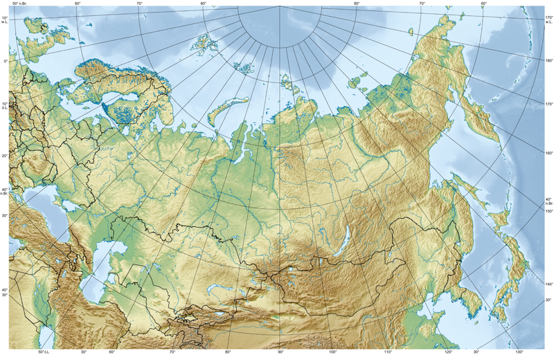
Like this?
Extent of Siberian Traps by Kaidor

Russland Relief by Kaidor
 0
0
Questions about Tesla
in Physics
Posted
Edison certainly pushed DC as something of a 'system piece like your furnace', but not for any altruistic or individual security motive. He simply wanted to be the supplier of the multitude of DC generators that would be required and so rake in the dough ray ME. Edison conspired in numerous public demonstrations wherein animals were electrocuted using AC in order to scare the public off Westinghouse and Tesla's AC system.
War of Currents